Check out the Best Deals on Amazon for DJI Drones today!
DJI Terra

DJI Zenmuse L3: The Features that Actually Move the Needle
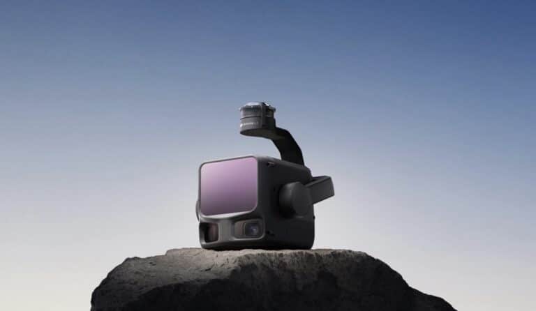
The Zenmuse L3 isn’t just another LiDAR payload bolted to a drone. It looks and feels like a single, purpose-built instrument, with attention paid to its smallest details. Once it’s in the air, that design isn’t just cosmetic. The LiDAR,…

DJI Zenmuse L3 LiDAR Doubles Detection Range To 950 Meters With Dual 100MP Cameras
DJI launched the Zenmuse L3 aerial LiDAR system today, featuring a 950-meter (3,117-foot) detection range and dual 100-megapixel cameras that dramatically extend professional mapping capabilities beyond the company’s previous L2 payload. The long-range system can cover up to 100 square…

FCC Grants Itself Authority to Retroactively Ban Drones, DJI Neo 2 and L3 LiDAR Leak, Plus $300K Fireworks Fine
Welcome to your weekly UAS news update, Halloween edition, where scary politicians create scary laws. I have three stories for you this week: The FCC votes on new powers, DJI drone and payload leaks, and a California homeowner facing a…

DJI Enterprise Teases Possible Zenmuse L3 LiDAR Payload For November 4 Launch
DJI Enterprise has released a teaser pointing to a November 4, 2025 launch event at 7 AM EST, with leaked photos suggesting the reveal could be a new LiDAR mapping payload—possibly the rumored Zenmuse L3. The cryptic tagline “See Through,…

DJI Enterprise Teases “Fly With Cloud Intelligence” Event for September 24
DJI Enterprise is set to unveil a new development in its cloud-based drone solutions, teasing an online event themed “Fly With Cloud Intelligence” scheduled for September 24, 2025. The announcement, made via a short video on the company’s official X…

DJI Terra 5.0 Update Introduces Photorealistic 3D Gaussian Splatting for Enhanced Drone-Based Mapping
DJI Enterprise released version 5.0.0 of its DJI Terra software today, incorporating photorealistic 3D Gaussian Splatting to produce highly realistic digital twins from drone imagery. This update accelerates LiDAR and multispectral data processing while integrating a seamless hardware-software workflow, addressing…

DJI Teases Enhancements to 3D Mapping Software with Upcoming Launch
DJI Enterprise has released a teaser video hinting at advancements in its digital asset creation tools, set for reveal on July 17, 2025, at 8 a.m. EDT. The short clip demonstrates point clouds evolving into a detailed 3D model of…

DJI’s Comprehensive Drone Mapping Solution: From Flight Planning to 3D Models
According to a recent YouTube video by Billy Kyle, DJI has streamlined the drone mapping process, offering a complete ecosystem for aerial surveying and 3D modeling. This integrated approach simplifies what was once a complex, multi-vendor workflow into a seamless…

DJI Unveils Dock 2: Next Generation of Automated Drone Ops
In a significant development for the drone industry, DJI, the global leader in civil drones and creative camera technology, has launched DJI Dock 2 worldwide. This innovative “drone in a box” solution, featuring the purpose-built DJI Matrice 3D/3TD drone, promises…

DJI’s Latest Firmware Update Unveiled For DJI Zenmuse L2 Camera
In a significant development for aerial photography and mapping technology, DJI has announced the release of a new firmware update for its Zenmuse L2 camera. Dated February 22, 2024, this update marks a significant leap forward in the capabilities of…

UAS Bill BB199, Drone Surveillance Update, New Wing Drone, New DJI Mic, and Mesh Editor
Welcome to the Weekly UAS News Update. This week, we have five stories for you, two of which are coming from St. Louis. Firstly, Wing has unveiled a new, larger drone designed for heavier packages. Then, we have two stories…

DJI Unveils Revolutionary 3D Model Editing Software: DJI Modify
A Leap in Aerial Surveying Technology DJI, a global leader in drone and creative camera technology, has launched a groundbreaking product: DJI Modify. This intelligent 3D model editing software is set to transform aerial surveying, transportation, and emergency response operations.…


