Phase One Unveils 247MP Drone Camera With 90% Smaller Files at INTERGEO 2025
Check out the Best Deals on Amazon for DJI Drones today!
High-end camera manufacturer Phase One rolled out a comprehensive drone imaging suite at INTERGEO 2025, featuring the flagship iXM-RS250 with 247-megapixel resolution, direct DJI M400 integration, and real-time quality control software designed to slash flight times and data storage requirements for commercial mapping operators.
The announcement represents a major push by Phase One into the commercial drone market, addressing critical pain points for survey and inspection professionals: massive data files that bog down workflows, time-consuming mission planning, and the need for platform flexibility without sacrificing professional-grade image quality.
iXM-RS250: Ultra-High Resolution Meets Workflow Efficiency
The iXM-RS250 represents Phase One’s next-generation aerial mapping camera, built around Sony’s IMX811 sensor delivering 247 megapixels at 19200×12800 resolution. The camera reduces flight time by 25-30% and requires up to 38% fewer images compared to previous systems, cutting fuel costs and aircraft hours while extending equipment lifespan.
The breakthrough feature is Phase One’s new IIQ-X compression format, which delivers up to 90% smaller files than traditional 16-bit TIFFs while maintaining image quality. For drone operators managing terabytes of aerial data, this translates to faster downloads, reduced storage costs, and accelerated post-processing workflows.
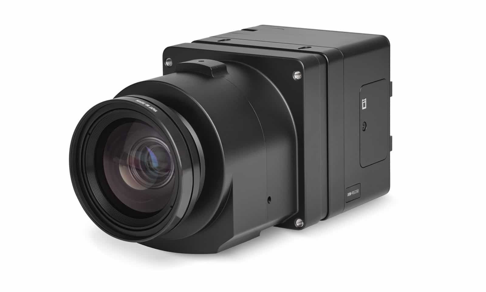
Six new RSX lenses were developed specifically for the iXM-RS250 sensor, supporting hybrid, compact, and oblique system configurations. The camera offers plug-and-play compatibility with existing iXM setups, allowing operators to upgrade without disrupting established operations.
Direct DJI M400 Integration Expands Platform Options
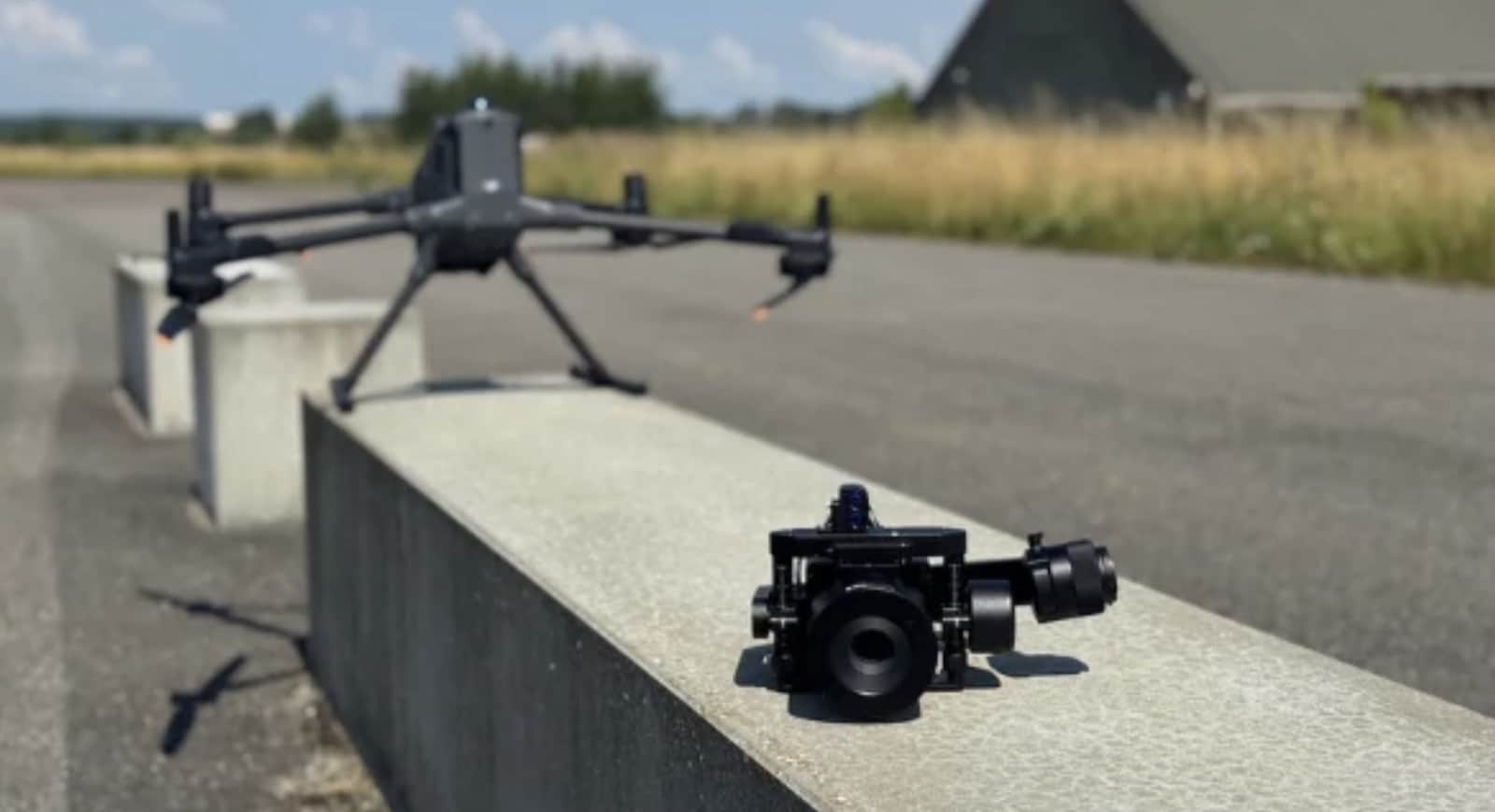
Phase One announced seamless integration of its P3 drone camera with the DJI M400 platform on October 1, building on successful compatibility with DJI’s M350 and M300 series. The P3 setup includes a Phase One medium-format camera (iXM-100 or iXM-GS120), dedicated gimbal, and choice of wide-area imaging or inspection lenses.
Operators control the Phase One camera directly through the DJI Pilot app, accessing real-time data and live streaming to monitor acquisition. Thomas Allin, Phase One’s Chief Technology Officer, said “with the P3 drone camera now fully compatible with the DJI M400, we are excited to offer customers even more flexibility and performance for their aerial imaging missions.”
The integration includes extended landing gear for simple installation and a quick-release dampening mount that allows operators to swap payloads without major reconfiguration. Phase One also extended its P5 camera integration to Abris drone platforms, giving surveyors additional platform choices for large-format image quality.
Real-Time Quality Control With iX Process 3.0
The new iX Process 3.0 software introduces automated quality checks on image overlap, ground sampling distance (GSD), and acquisition metrics immediately after data capture. The system allows operators to validate data in near real-time, detecting mission issues before leaving the field and reducing costly re-flights.
Visual inspection tools and completion checks help operators confirm data quality on-site rather than discovering problems during post-processing. The software supports flexible customized camera system setups across Phase One’s product line.
Ecosystem Partnerships Expand Workflow Integration
Phase One showcased extensive partner integrations at INTERGEO, including IGI’s CM-1 compact aerial system with an integrated Phase One camera component, and AISPECO’s new HELIUX XL system equipped with Phase One 4-band imagery for utilities, forestry, mining, and urban mapping applications.
The company’s Intelligent Image Quality (IIQ) format is embedded into platforms from Bentley, Trimble Applanix, Skyline, Blue Marble, Catalyst, SimActive, Terrasolid, gNext, and Pointerra, ensuring drone-acquired data integrates cleanly into enterprise geospatial workflows.
DroneXL’s Take
Phase One has been steadily building its drone imaging portfolio since we covered their 128MP P5 Survey Payload in late 2023 and their Acecore integration back in 2020. This INTERGEO announcement shows they’re not just dipping a toe into the commercial drone market—they’re diving in with both feet.
The real story here isn’t just megapixel counts. It’s about solving the practical problems that commercial drone operators face every day: storage costs eating into profits, processing bottlenecks delaying deliverables, and the eternal question of whether to commit to proprietary systems or stick with familiar platforms like DJI. Phase One’s approach—bring professional imaging quality directly into the DJI ecosystem—addresses all three issues simultaneously.
The 90% file size reduction through IIQ-X compression is particularly significant. When you’re running multiple mapping missions per week, the difference between managing 10TB versus 1TB of data isn’t just convenience—it’s the difference between same-day deliverables and week-long processing queues. Add real-time quality control that catches problems in the field, and you’ve got a system designed by people who understand production workflows.
What Phase One hasn’t announced yet is pricing or exact availability dates for the iXM-RS250. That matters, because professional-grade medium-format cameras don’t come cheap. But for survey firms, inspection companies, and mapping operations where image quality directly impacts deliverable accuracy and client satisfaction, the ROI calculation might be straightforward: fewer flights, smaller files, less rework, happier clients.
What do you think? Share your thoughts in the comments below.
Discover more from DroneXL.co
Subscribe to get the latest posts sent to your email.
Check out our Classic Line of T-Shirts, Polos, Hoodies and more in our new store today!

MAKE YOUR VOICE HEARD
Proposed legislation threatens your ability to use drones for fun, work, and safety. The Drone Advocacy Alliance is fighting to ensure your voice is heard in these critical policy discussions.Join us and tell your elected officials to protect your right to fly.
Get your Part 107 Certificate
Pass the Part 107 test and take to the skies with the Pilot Institute. We have helped thousands of people become airplane and commercial drone pilots. Our courses are designed by industry experts to help you pass FAA tests and achieve your dreams.

Copyright © DroneXL.co 2026. All rights reserved. The content, images, and intellectual property on this website are protected by copyright law. Reproduction or distribution of any material without prior written permission from DroneXL.co is strictly prohibited. For permissions and inquiries, please contact us first. DroneXL.co is a proud partner of the Drone Advocacy Alliance. Be sure to check out DroneXL's sister site, EVXL.co, for all the latest news on electric vehicles.
FTC: DroneXL.co is an Amazon Associate and uses affiliate links that can generate income from qualifying purchases. We do not sell, share, rent out, or spam your email.


