DJI releases interactive ‘Drone-Assisted Rescues Worldwide’ map

Check out the Best Deals on Amazon for DJI Drones today!
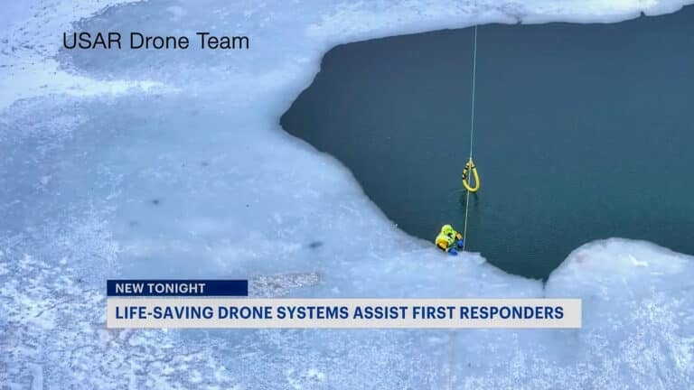
Finally, it is here! DJI’s Adam Lisberg once told me how much work it was to chase, verify, and compile the news stories in which drones played an often crucial role in helping to save somebody’s life. Today, DJI released a global map that showcases all the known Drone-Assisted Rescues Worldwide. 413 lives have been saved with the help of drones in 234 incidents in 24 countries as of today. This is a great initiative as it helps drive the point across that drones are not only the safest form of aviation but also help in saving people’s lives. I would add to this that in doing so, drones are still massively underused. Supplying more first responders across the world with more unmanned aircraft would go a long way in rescuing even more people.
DJI releases interactive ‘Drone-Assisted Rescues Worldwide’ map
As of today, 413 lives have been saved with the help of drones in 234 incidents in 24 countries. As there is no official database tracking these numbers, DJI complies this list “from news stories and social media posts from authoritative sources such as police departments, fire departments and volunteer rescue squads.” When you browse the map you can click on regions, zoom in, and click on individual stories to learn the exact details of that situation.
DJI’s Brendan Schulman said the following about the new ‘Drone-Assisted Rescues Worldwide’ map: “A powerful resource for policymakers to understand the impact drones have on protecting vulnerable people in their own communities. Regions with less favorable operating rules for drones appear to have substantially fewer reports of drone rescues.”

Since no official global database exists, the new ‘Drone-Assisted Rescues Worldwide‘ map from DJI is currently the best resource available. DJI’s system also allows for people to share news stories in which drones helped to save somebody’s life and I urge you to do so as these positive stories are the best way forward to promote our industry.
“The DJI Drone Rescue Map is now the best global reference for how effective drones are in emergencies, and allows the world to see the tremendous impact drones have had in finding lost people, shortening searches, reducing risks to rescuers and saving lives,” said Romeo Durscher, DJI Senior Director of Public Safety Integration. “Public safety workers already know how drones are revolutionizing their work, and now the rest of the world can see their amazing stories in one place. The DJI Drone Rescue Map honors the incredible rescues they’ve made, and will allow everyone to see how drones help save people in the future.”
DJI’s ‘Drone-Assisted Rescues Worldwide’ map only shows the stories in which a drone played a crucial role in locating or rescuing the person or persons.
The map does not include incidents when a drone is simply used as part of a larger search process; instead, a drone must have directly located, assisted and/or rescued a person in peril.
All drones for good stories, when submitted to DJI, will be reviewed before being posted on the ‘Drone-Assisted Rescues Worldwide’ map. The drone maker also asks DJI asks anyone who is “submitting information about a rescue to respect the privacy rights and expectations of the persons involved, and to not share any confidential or sensitive information about agency operations.”
“Drones have changed the game for finding and saving people lost in difficult conditions, and twice last year drones made the difference for us in finding and saving stranded hikers in dangerous terrain at night,” said Kyle Nordfors, Drone Team Coordinator for Weber County Search and Rescue in Utah. “Drones helped make these rescues possible while reducing risk and strain on our volunteer rescue force. We’re excited to see our successful efforts represented on the DJI Drone Rescue Map, and we hope it shows people all over the world how important drones are for saving lives and protecting the rescuers.”

“A powerful resource for policymakers to understand the impact drones have on protecting vulnerable people in their own communities. Regions with less favorable operating rules for drones appear to have substantially fewer reports of drone rescues.”https://t.co/HP4kdbZGx0
— Brendan Schulman (@dronelaws) June 29, 2020
Stay in touch!
If you’d like to stay up to date with all the latest drone news, scoops, rumors, and reviews, then follow us on Twitter, Facebook, YouTube, Instagram or…
Subscribe to our Daily Drone News email.*
Submit tips If you have information or tips that you would like to share with us, feel free to submit them here. Support DroneXL.co: You can support DroneXL.co by using these links when you make your next drone purchase: Adorama, Amazon, B&H, BestBuy, eBay, DJI, Parrot, and Yuneec. We make a small commission when you do so at no additional expense to you. Thank you for helping DroneXL grow! FTC: DroneXL.co uses affiliate links that generate income.
* We do not sell, share, rent out or spam your email, ever. Our email goes out on weekdays around 5:30 p.m.
Discover more from DroneXL.co
Subscribe to get the latest posts sent to your email.
Check out our Classic Line of T-Shirts, Polos, Hoodies and more in our new store today!

MAKE YOUR VOICE HEARD
Proposed legislation threatens your ability to use drones for fun, work, and safety. The Drone Advocacy Alliance is fighting to ensure your voice is heard in these critical policy discussions.Join us and tell your elected officials to protect your right to fly.
Get your Part 107 Certificate
Pass the Part 107 test and take to the skies with the Pilot Institute. We have helped thousands of people become airplane and commercial drone pilots. Our courses are designed by industry experts to help you pass FAA tests and achieve your dreams.

Copyright © DroneXL.co 2026. All rights reserved. The content, images, and intellectual property on this website are protected by copyright law. Reproduction or distribution of any material without prior written permission from DroneXL.co is strictly prohibited. For permissions and inquiries, please contact us first. DroneXL.co is a proud partner of the Drone Advocacy Alliance. Be sure to check out DroneXL's sister site, EVXL.co, for all the latest news on electric vehicles.
FTC: DroneXL.co is an Amazon Associate and uses affiliate links that can generate income from qualifying purchases. We do not sell, share, rent out, or spam your email.


