DJI Zenmuse L3 LiDAR Doubles Detection Range To 950 Meters With Dual 100MP Cameras
Check out the Best Deals on Amazon for DJI Drones today!
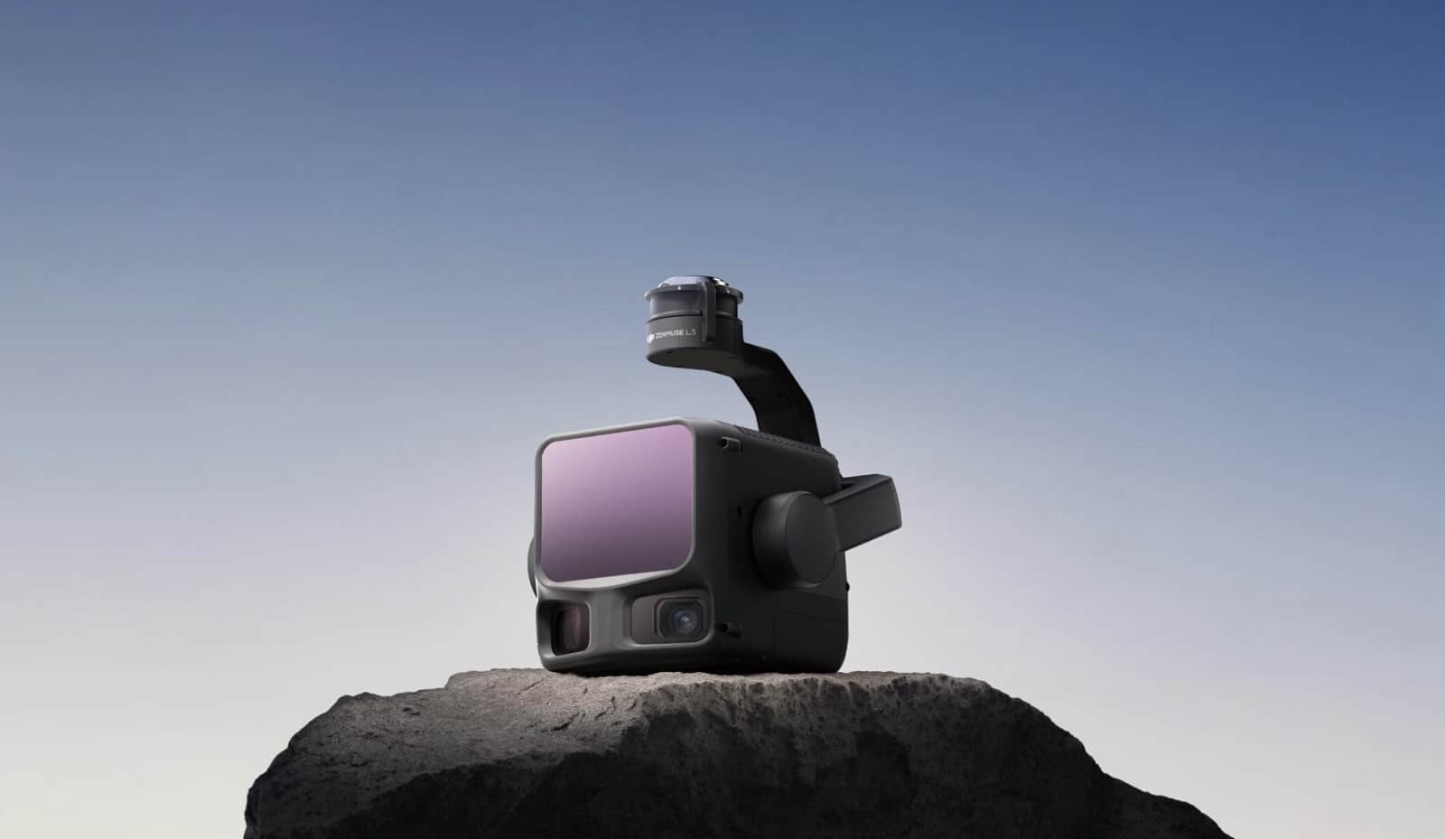
DJI launched the Zenmuse L3 aerial LiDAR system today, featuring a 950-meter (3,117-foot) detection range and dual 100-megapixel cameras that dramatically extend professional mapping capabilities beyond the company’s previous L2 payload. The long-range system can cover up to 100 square kilometers (38.6 square miles) per day when mounted on the Matrice 400 drone platform.
DJI announced the L3 represents its most significant leap in survey-grade LiDAR technology, completing an enterprise ecosystem overhaul that began with the Matrice 400 launch in June and the DJI Terra 5.0 software update in July 2025.
Why This Matters For Drone Operators
The Zenmuse L3’s extended range and improved accuracy position it as serious competition for specialized LiDAR manufacturers charging $150,000 to $250,000 for comparable systems. For surveying professionals, forestry managers, and infrastructure inspectors already invested in DJI’s Matrice ecosystem, the L3 offers survey-grade capabilities at a fraction of traditional costs while maintaining compatibility with existing M300 and M350 RTK platforms.
Long-Range Detection And High-Accuracy System
The L3’s 1535nm wavelength LiDAR achieves its 950-meter detection range at a pulse rate of 100 kHz, tested under 100 klux ambient light on objects with just 10% reflectivity—more than double the L2’s 450-meter (1,476-foot) maximum range. The adjustable pulse rate allows flexible power output from 100 kHz to 2 MHz, adapting to various operational scenarios from high-altitude wide-area mapping to low-altitude detail capture.
DJI’s self-developed LiDAR delivers ranging repeatability of 5 millimeters (0.2 inches) at 150 meters (492 feet) with microsecond-level time synchronization. Vertical accuracy reaches 3 centimeters (1.2 inches) at 120 meters (394 feet), 5 centimeters (2 inches) at 300 meters (984 feet), and 10 centimeters (3.9 inches) at 500 meters (1,640 feet) flight altitude—supporting mapping projects at 1:500, 1:1000, and 1:2000 scales.
The laser beam divergence of just 0.25 milliradians means the spot size at any given range is approximately one-fifth that of the Zenmuse L2, enabling detection of smaller objects like power lines and tree branches with significantly greater precision.
Dual 100MP RGB Cameras For True-Color Mapping
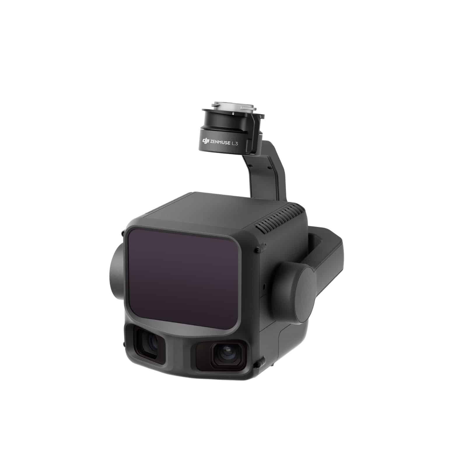
The L3 features dual 100-megapixel 4/3 CMOS RGB sensors with mechanical shutters—a fivefold increase over the L2’s 20-megapixel sensor. This resolution jump delivers a ground sample distance of 3 centimeters (1.2 inches) even at 300-meter (984-foot) flight altitude, producing remarkably detailed orthophotos and true-color point clouds.
The dual camera system provides a horizontal field of view of 107 degrees, capturing broader areas in each frame while maintaining sharp structural detail. Operators can choose between 6K (25MP) or 12K (100MP) capture modes depending on mission requirements, with shooting intervals as fast as 0.5 seconds at 25MP and 1.2 seconds at 100MP for comprehensive coverage at speed.
Advanced Penetration With 16 Returns
DJI’s announcement highlighted the L3’s support for up to 16 returns per laser pulse—more than triple the L2’s five returns—combined with a maximum emission frequency of 2 million points per second. This dramatically improves terrain mapping in dense forests and urban environments by capturing multiple surface reflections from each pulse.
The system introduces a Star-Shaped scanning mode that balances accuracy with multiple scan angles, complementing traditional Linear and Non-Repetitive scanning patterns. This versatility proves especially valuable for forestry surveying where dense canopy coverage hides ground features, and infrastructure inspection where complex structures require comprehensive point cloud coverage.
High-Efficiency Coverage Capability
When mounted on the DJI Matrice 400, the L3 can cover up to 10 square kilometers (3.9 square miles) in a single flight at typical 300-meter (984-foot) altitude. This efficiency enables up to 100 square kilometers (38.6 square miles) of daily coverage—a significant productivity increase for large-scale topographic surveys, emergency response mapping, and energy infrastructure inspections.
The system captures LiDAR and RGB data simultaneously to generate multiple mapping deliverables from a single flight, including digital orthophoto maps and digital elevation models, even with just 20% LiDAR side overlap ratio. This multi-output capability reduces flight time requirements while improving both geometric and visual accuracy of final deliverables.
Seamless Ecosystem Integration
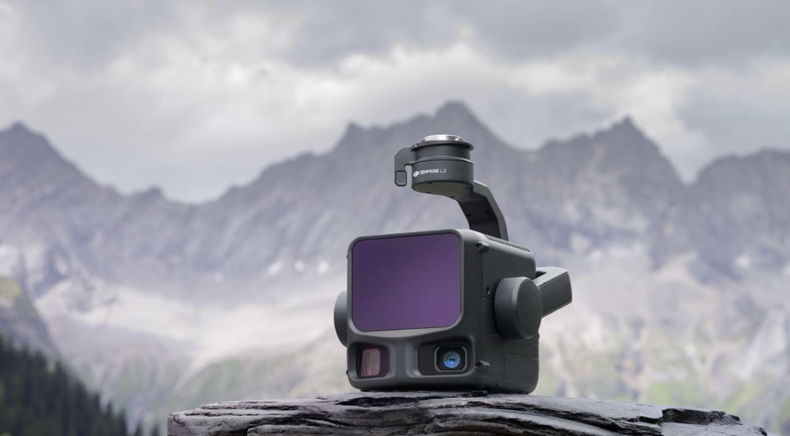
The L3 integrates with DJI’s complete enterprise software ecosystem, including the D-RTK 3 Multifunctional Station, DJI Pilot 2, DJI Terra, DJI Modify, and DJI FlightHub 2. From data acquisition through processing to application, this unified workflow simplifies operations compared to traditional multi-platform setups requiring different software for each stage.
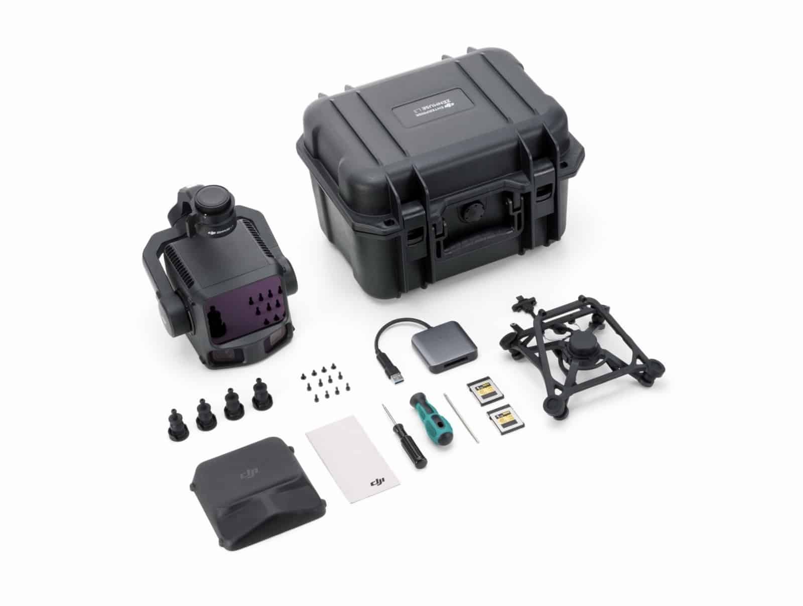
The payload weighs 1.6 kilograms (3.5 pounds) and maintains compatibility with the Matrice 300 RTK and Matrice 350 RTK platforms in addition to the newer Matrice 400, ensuring existing DJI enterprise customers can upgrade without replacing their entire aerial platform.
Availability And Pricing
The Zenmuse L3 is available now through authorized DJI Enterprise dealers worldwide. DJI has not disclosed pricing, though industry observers expect the L3 to follow DJI’s pattern of aggressive price disruption—the original Zenmuse L1 brought LiDAR capabilities from $100,000+ systems down to approximately $20,000 complete systems in 2020, while the L2 launched at $13,560 in 2023.
DroneXL’s Take
DJI’s Zenmuse L3 represents the culmination of a carefully orchestrated enterprise ecosystem upgrade that began when the company launched the Matrice 400 heavy-lift platform in June 2025. That flagship drone brought 59-minute flight times and 6-kilogram (13.2-pound) payload capacity specifically designed to handle more capable sensors. The DJI Terra 5.0 software update followed in July with photorealistic 3D Gaussian Splatting and dramatically faster LiDAR processing—20% to 50% speed improvements depending on dataset size. Now the L3 payload completes the picture with hardware capabilities that finally justify the M400’s expanded capacity.
The progression from L1 to L2 to L3 shows DJI’s consistent strategy: enter a market dominated by specialized manufacturers charging premium prices, then systematically improve performance while maintaining accessible pricing. When the Zenmuse L1 launched in 2020, it democratized LiDAR surveying by bringing costs down from six figures to around $20,000. The L2’s October 2023 release at $13,560 pushed boundaries further with one-fifth the spot size and 30% greater detection range. The L3 nearly doubles that range again while tripling returns and quintupling camera resolution—specs that would typically command $150,000 to $250,000 from competitors like Phoenix LiDAR Systems or YellowScan.
This timing matters because DJI faces mounting political pressure in the United States, including the looming December 23, 2025 FCC deadline that could automatically ban DJI products and ongoing investigations into shell company workarounds. The L3 launch demonstrates DJI’s commitment to serving the enterprise market despite regulatory uncertainty—or perhaps because of it. By completing a comprehensive ecosystem upgrade across hardware, software, and payload capabilities, DJI makes it increasingly difficult for NDAA-compliant competitors to match the integrated workflow efficiency that surveying professionals have come to expect.
The competitive landscape has shifted since we first covered the L3 leaked images and teasers last week. GeoCue just announced the TrueView 641 NDAA-compliant LiDAR at INTERGEO 2025, offering 400-meter range and sub-4-millimeter accuracy at accessible pricing. Teledyne’s EchoONE provides NDAA compliance with 1.5-centimeter vertical accuracy at 120-meter altitude. These alternatives address data security concerns that increasingly influence U.S. government and critical infrastructure contracts. Yet none can match DJI’s complete ecosystem integration—from the D-RTK 3 ground station through automated flight planning in Pilot 2, one-click processing in Terra, and model refinement in Modify.
The real question isn’t whether the L3 represents impressive technical achievement—it clearly does. Rather, surveying professionals must weigh performance and price against growing regulatory restrictions and potential supply chain disruptions. For international operators and commercial applications without NDAA requirements, the L3 likely represents the best value in professional aerial LiDAR. For U.S. government contractors and critical infrastructure work, the calculus grows more complex as compliance requirements increasingly outweigh pure performance metrics.
What do you think about DJI’s latest LiDAR breakthrough? Will regulatory concerns outweigh the L3’s technical capabilities for your operations? Share your thoughts in the comments below.
Discover more from DroneXL.co
Subscribe to get the latest posts sent to your email.
Check out our Classic Line of T-Shirts, Polos, Hoodies and more in our new store today!

MAKE YOUR VOICE HEARD
Proposed legislation threatens your ability to use drones for fun, work, and safety. The Drone Advocacy Alliance is fighting to ensure your voice is heard in these critical policy discussions.Join us and tell your elected officials to protect your right to fly.
Get your Part 107 Certificate
Pass the Part 107 test and take to the skies with the Pilot Institute. We have helped thousands of people become airplane and commercial drone pilots. Our courses are designed by industry experts to help you pass FAA tests and achieve your dreams.

Copyright © DroneXL.co 2026. All rights reserved. The content, images, and intellectual property on this website are protected by copyright law. Reproduction or distribution of any material without prior written permission from DroneXL.co is strictly prohibited. For permissions and inquiries, please contact us first. DroneXL.co is a proud partner of the Drone Advocacy Alliance. Be sure to check out DroneXL's sister site, EVXL.co, for all the latest news on electric vehicles.
FTC: DroneXL.co is an Amazon Associate and uses affiliate links that can generate income from qualifying purchases. We do not sell, share, rent out, or spam your email.


