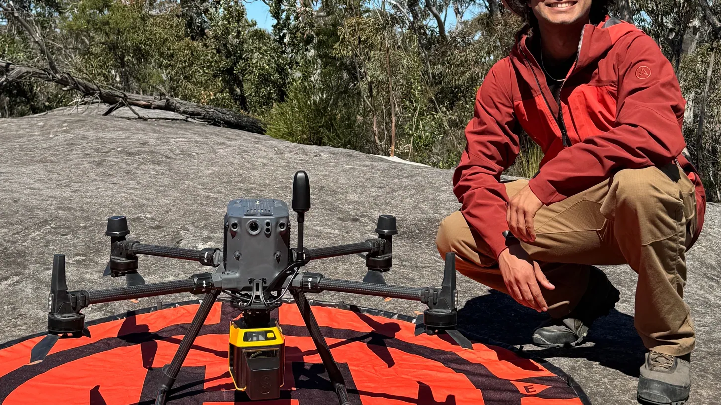
Archaeologists at the University of Sydney flew a DJI Matrice 350 carrying a YellowScan Explorer V2 LiDAR over the Blue Mountains west of Sydney and found three Aboriginal rock shelters that were missing from New South Wales’ official heritage register. All three hold stone tools, and one has a pair of red hand stencils on a rock panel. The survey also pinned down six shelters already on the register, and the drone’s coordinates landed closer to the real sites than the register’s own. The work was done with the Dharug Custodian Aboriginal Corporation and published in the journal Remote Sensing on October 12, with a university release following on October 14.
The university calls the three shelters “previously unregistered.” The project’s co-director, Wayne Brennan, told the Australian Associated Press that skilled bushwalkers had already spotted all three.
The Matrice 350 flew four zones at 246 feet and flagged 2,017 spots
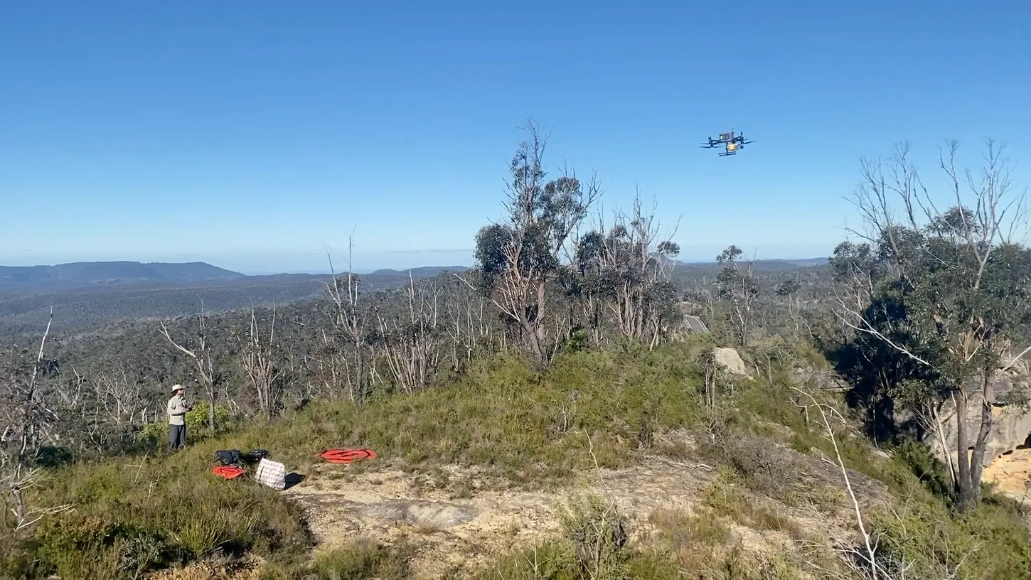
The team flew the Matrice 350 at 246 feet (75 meters) above ground over four zones near Mount Irvine and Djulpura, in crosshatch patterns at 16 to 22 mph (7 to 10 m/s). That produced at least 100 LiDAR points per square meter, against 0.5 for the state’s aircraft data.
A Leica GS16 base station and SBG Systems’ Qinertia software corrected the flight tracks to under 4 inches (10 centimeters). The team then stripped the trees out of the point cloud, rebuilt the bare ground, and ran a model in ArcGIS Pro that looks for the shape of an overhang: a sharp vertical step, a steep slope, and open ground in front of it. Across the four zones the model flagged 2,017 candidate spots.
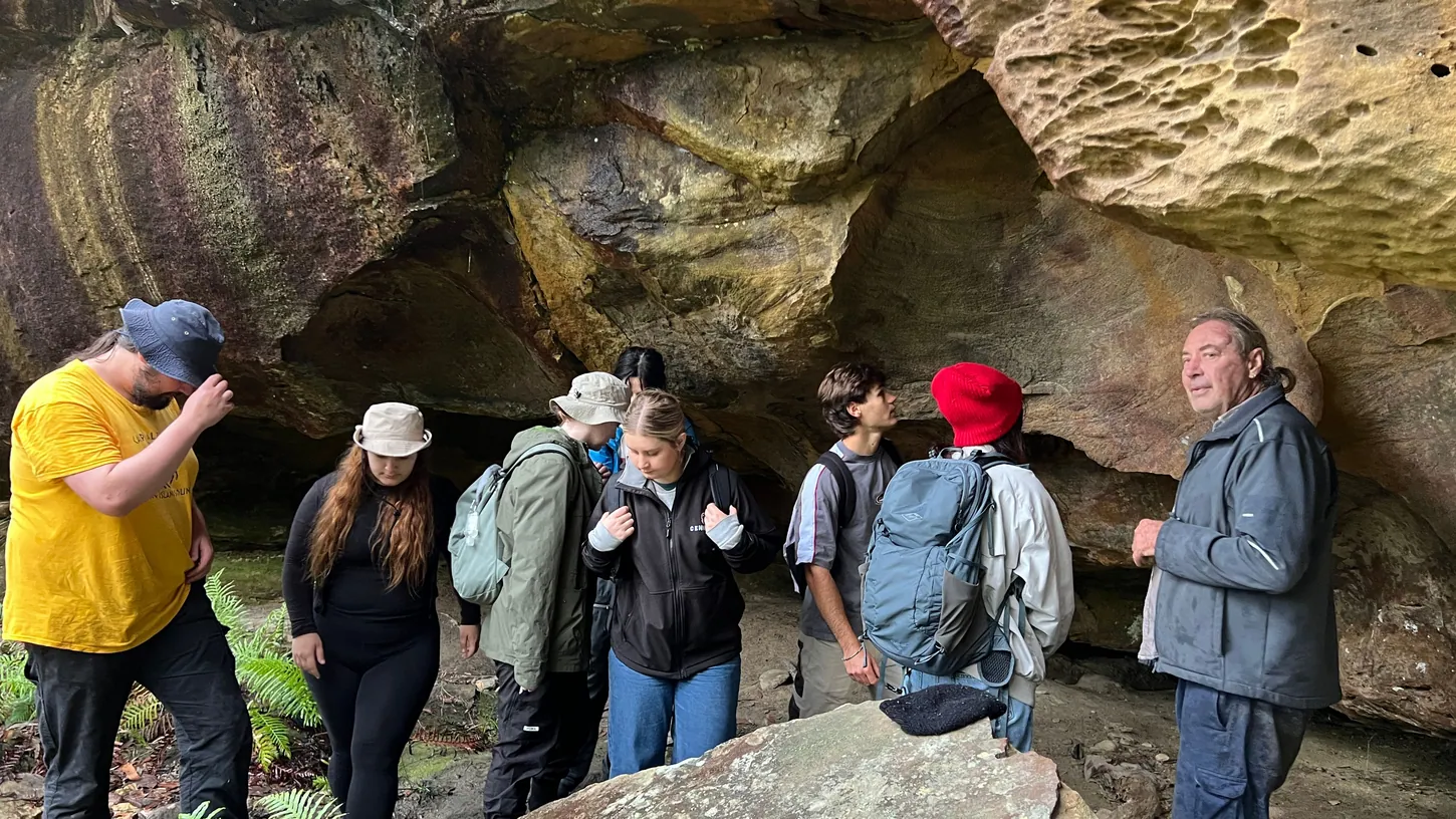
The team inspected the most promising candidates in 3D point cloud profiles before anyone walked in, then checked 19 of them on foot. Every one of the 19 was a shelter, an overhang or a recessed cavity. Three of them, now logged as BM139, BM140 and BM141, had no entry in the Aboriginal Heritage Information Management System, the NSW register known as AHIMS. BM139 had three large stone artifacts on its floor. BM140 had 21, plus a panel of two red pigment hand stencils, a left and a right side by side, about 14 by 6 inches (35 by 15 centimeters) in total, which the team reads as one person’s work in a single sitting. BM141, near the Pierces Pass walking track, had 26 artifacts on a quick surface inspection.
Bushwalkers knew the shelters, and the register’s coordinates were off
Brennan, a Gomeroi man and the project’s rock art expert, told AAP that researchers had learned of the three shelters from skilled bushwalkers before the flights, and the drone confirmed them. “So we know people have stayed there,” he said of the stone tools on the floors.
The paper is blunter about the register than the press release is. AHIMS records can be uploaded by anyone with an account, nobody checks the coordinates, and many older entries were converted from paper maps and older coordinate systems with errors along the way. The result, the authors write, is that listed positions are “sometimes hundreds of metres off” the actual site. For six known shelters the team measured the gap between the register’s coordinates and the drip line it mapped on the ground, and the drone’s detections sat on or within 3 feet (1 meter) of the real drip lines at Honey Upgrade and Morley’s Creek. The team has set up its own database, called Coolamon, to re-record sites with corrected positions. The paper, by lead author Jacob Bongers and co-directors Amy Mosig Way and Brennan, is open access at Remote Sensing, and the University of Sydney release carries the field photos.
The model’s hit rate is still unknown across 408 square miles
Run on the state’s free aircraft LiDAR over the full 408-square-mile (1,057 square kilometer) study area, the same shelter-finding logic produced 751,655 detections. All 85 registered shelters in that area had a detection within about 126 feet (38 meters), but nobody has walked those spots, so the false-alarm rate is unknown.
The authors say so themselves. The 19 candidates they checked were hand-picked after looking at the point clouds, not sampled at random, so the paper cannot report precision, recall or a false-negative rate. The thresholds were also tuned for Blue Mountains sandstone and bush, and the team expects to recalibrate before using them anywhere else. The paper notes the team used ChatGPT to help refine the logic of the ArcGIS models, with the parameters set and checked by the authors.
The scale problem is the reason the method exists. More than 200 rock shelters with cultural material are recorded in the Blue Mountains, and Way estimates only about 10% of the region has ever been surveyed because of the terrain. The Gulamada Project, which carries this work, got AU$248,610 from the Australian government’s First Nations Heritage Grants program. Next stops are the tropical savannas of western Arnhem Land and the semi-arid country of western NSW, with local Aboriginal communities. Bongers calls the approach “an efficient and accurate way to locate sites in rugged environments.”
DroneXL’s Take
The AAP headline that ran across Australian papers on October 14 says ancient sites were uncovered by laser drones, and earth.com went with drones discovering ancient rock art. The paper says the survey located the shelters, and its co-director says bushwalkers had seen all three first. I’d rather have the second version, because the real result is better than the headline. A LiDAR drone turned 408 square miles of cliff country into a ranked list of overhangs, and then put the known sites back where they belong after the state database had them hundreds of meters adrift. That is the same job Bongers did at Peru’s Band of Holes with a Mavic 3E, and the same one a Matrice 400 did over Maya cities in Guatemala in March. Until someone walks a random sample of those 751,655 detections and reports how many were rock, this is a very good filter and not yet a detector, and the authors deserve credit for saying exactly that.
Sources: Remote Sensing, University of Sydney, AAP via National Indigenous Times
DroneXL uses automated tools to support research and source retrieval. All reporting and editorial perspectives are by Haye Kesteloo. Read our editorial standards.