AutoPylot, one of the FAA-approved providers of B4UFLY and LAANC, has put local drone rules on its flight map. The feature, called Pilot Reports, opened to every pilot in all 50 states on November 9 in the free AutoPylot app, on phones and on the web. It starts with nearly 2,000 local rules. Pilots can view them without an account and need one only to add a rule.
Federal data stops at the airspace. A pilot can hold a valid LAANC authorization and still be breaking a city ordinance, a state park order, or the sign at a trailhead, because none of those appear in FAA data. DroneXL has covered that gap in Raleigh’s park rules and in the ordinance Olathe, Kansas pulled after a local pilot pushed back.
AutoPylot already had a list of every local drone ordinance it could find, linked from its pre-flight checklist. Pilots have opened it close to 100,000 times.
AutoPylot Opened the Map to Pilots Because Its Own List Never Caught Up
AutoPylot’s ordinance list was a static help article that was never complete and sat outside the map pilots plan on. Pilot Reports moves those rules onto the flight map and opens it to submissions, so pilots can add rules the company missed, including posted signs.
In its Pilot Reports announcement, AutoPylot says local rules are spread across thousands of separate municipal websites, often in code sections that never mention drones by name. Founder Tauty Shalna, in a message to DroneXL, called Pilot Reports “Waze, but for local airspace regulations instead of traffic.”
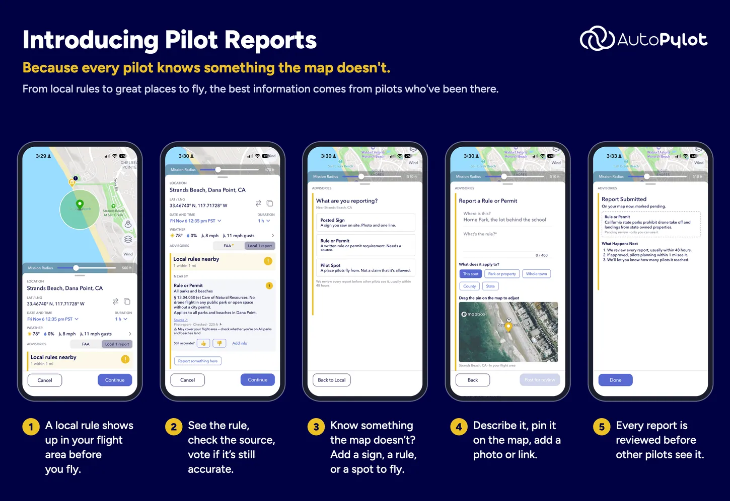
Pilots can file three kinds of report. A Posted Sign needs a photo and one line of description. A Rule or Permit needs the rule text and a source. A Pilot Spot marks a place where pilots fly and makes no claim about whether flying there is allowed. Each submission gets a boundary (the single spot, a park or property, a whole town, a county or a state) and a pin the pilot drags into place, with optional links or photos as evidence.
Pilot Reports Separates Rules That Apply From Rules That Might
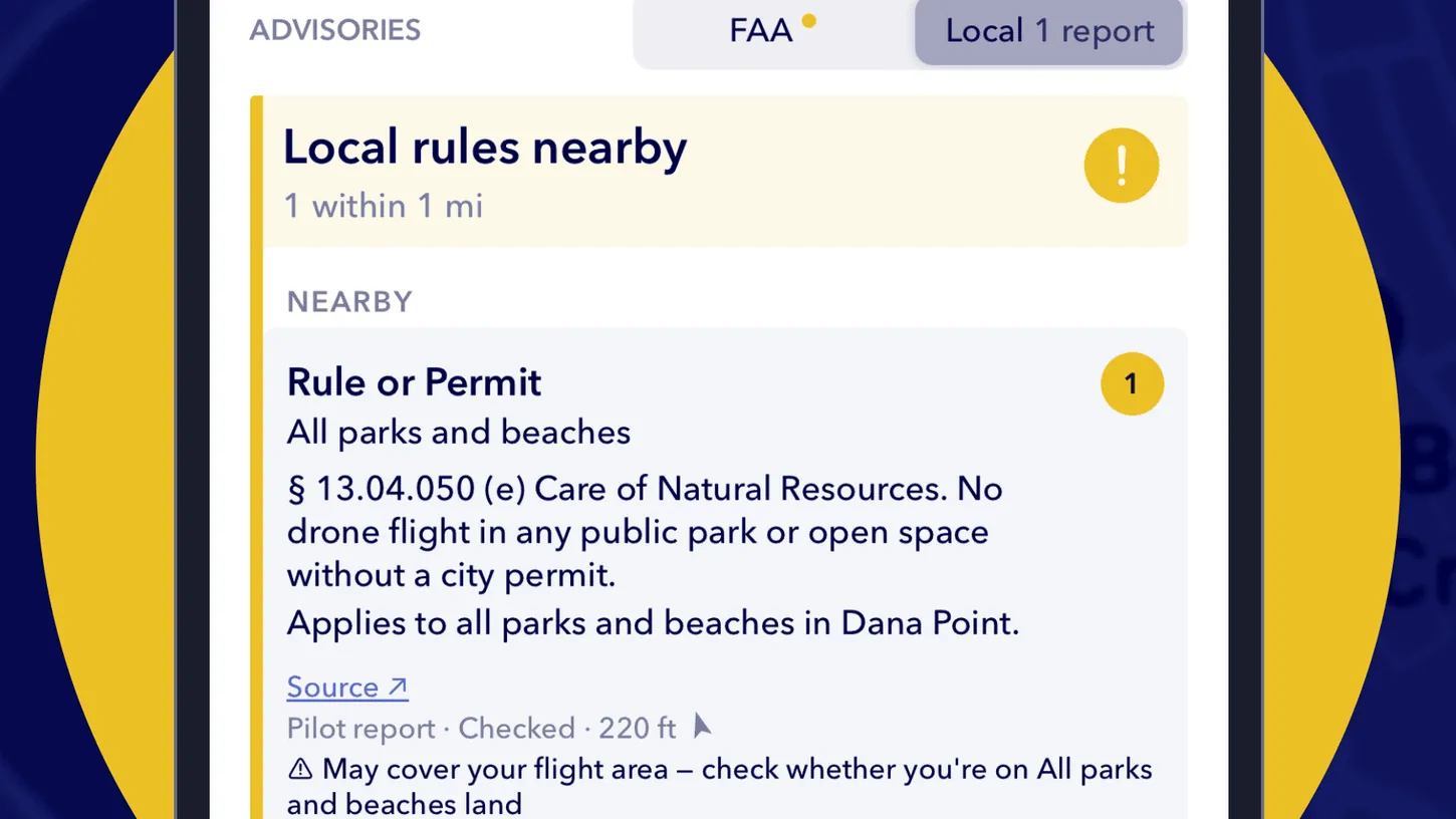
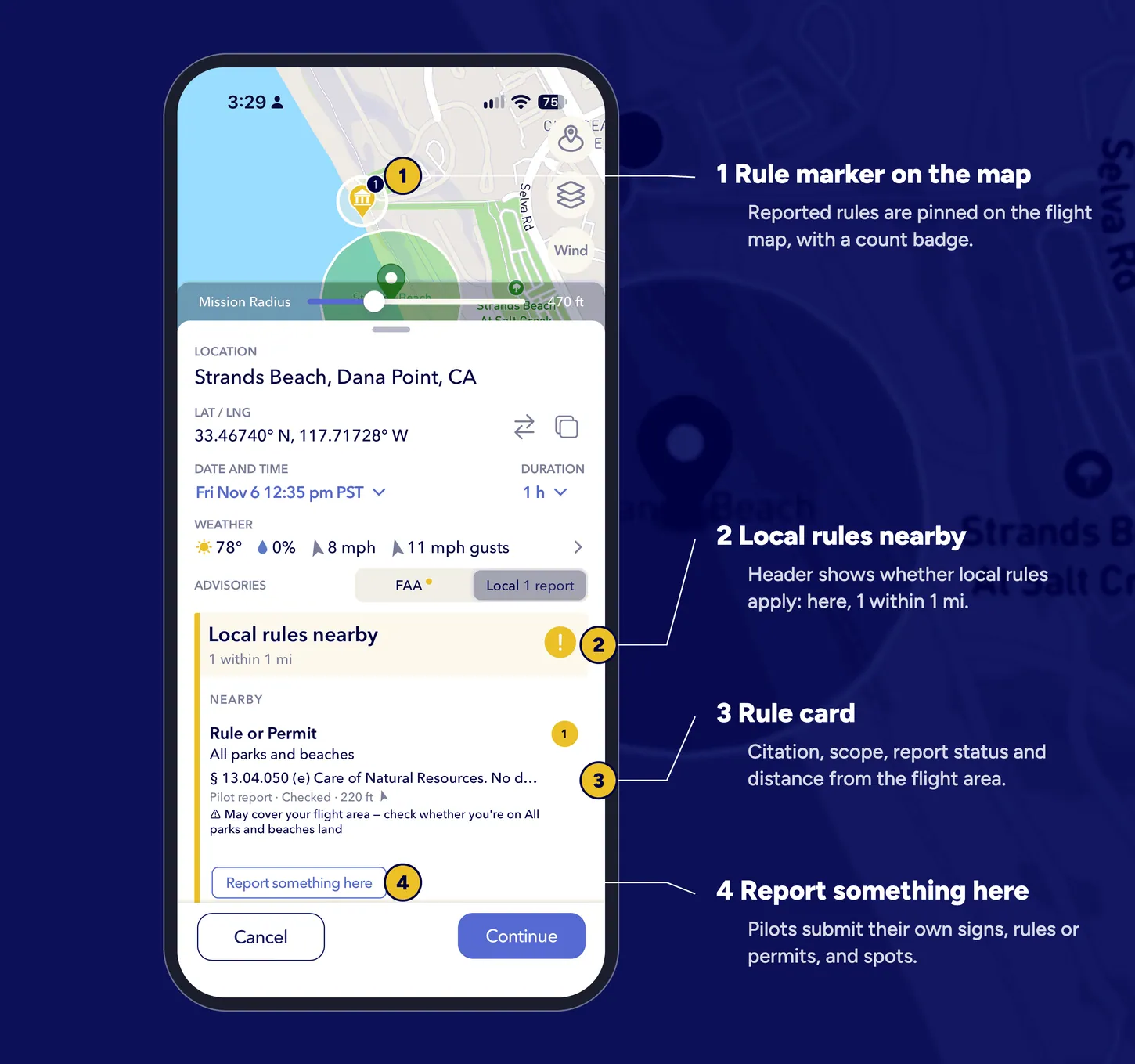
Pilot Reports marks a rule as applying when it covers the whole area a pilot is planning in, such as a city ordinance for the entire municipality. A rule covering only that city’s parks or beaches shows as possibly affecting the flight, because the pilot may not be in one.
AutoPylot reviews every submission before other pilots see it, usually within 48 hours. Until then, only the pilot who filed a report can see it. Once approved, it shows up for anyone planning a flight within one mile, and the submitter learns how many pilots it reached.
Every rule card carries its source. Pilots can mark a rule as still accurate or out of date with a single tap, which AutoPylot expects to be the most common way pilots contribute. The nearly 2,000 rules on the map so far came from the company’s own research and from pilots during a beta that Shalna says started a few weeks ago.
DroneXL’s Take
I’d tell pilots to tap the source link on every card before anything else. A lot of local “drone laws” govern the ground, where a city can legitimately control takeoffs and landings on its own property, and some reach for the airspace, which belongs to the FAA. Raleigh’s park guidelines restated federal flight rules as if they were city rules. Showing the source, and marking a parks-only rule as one that might not apply, lets a pilot read the actual text and decide what it covers. When the University of Alabama repeated its game-day drone ban at Bryant-Denny Stadium, I pointed readers to B4UFLY or AutoPylot for the stadium flight restriction, and neither would have told them about a sign at a trailhead. A park ranger writing a ticket doesn’t care about your LAANC approval. Check the local layer before you drive out.
Sources: AutoPylot, FAA B4UFLY
DroneXL uses automated tools to support research and source retrieval. All reporting and editorial perspectives are by Haye Kesteloo. Read our editorial standards.