AI and Drones Team Up to Find Missing Hiker in Italian Alps After 10 Months
Check out the Best Deals on Amazon for DJI Drones today!
A hiker’s helmet glows red in drone footage, courtesy of AI magic, ending a gut-wrenching saga that hits home for adventurers.
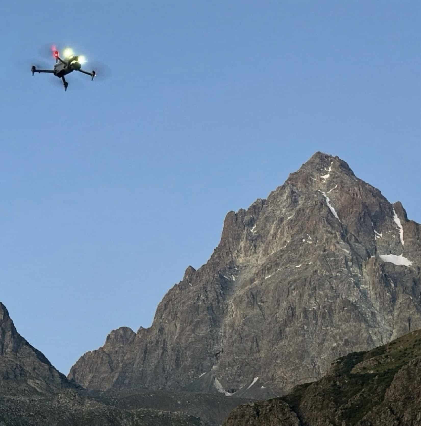
A mountain rescue team in Italy harnessed artificial intelligence to scan drone-captured images, spotting a missing hiker’s helmet in rugged terrain and enabling swift recovery of his body. This operation highlights how AI integration is transforming search and rescue efforts for drone operators.
The Search and Recovery Mission
In the Piedmont region of Italy, on the north face of Monviso—the highest peak in the Cottian Alps at over 12,600 feet (3,841 meters)—rescuers faced a daunting task, reports Wired. They needed to scour a 452-acre (183-hectare) area for signs of 64-year-old doctor Nicola Ivaldo, who vanished in September 2024. Traditional methods might have dragged on for weeks, but drone technology cut the timeline dramatically.
The National Alpine and Speleological Rescue Corps (CNSAS) deployed two drones on July 29, capturing 2,600 frames from about 164 feet (50 meters) away in just five hours. That afternoon, AI software processed the images, flagging “suspicious spots” by detecting color anomalies—like the hiker’s helmet contrasting against the landscape. Fog halted progress the next day, but on July 31, the team confirmed the find at approximately 10,335 feet (3,150 meters) elevation, 1,969 feet (600 meters) below the summit, in one of three ravines above a hanging glacier.
Saverio Isola, a CNSAS drone pilot, detailed the process: “It was the AI software that identified some pixels of a different color in the images taken on Tuesday.”
He and colleague Giorgio Viana, supported by four expert mountain rescuers, used cell phone data from Ivaldo to guide their flights. By 4 a.m. on the confirmation day, they repositioned for optimal visibility and sent a drone to verify the red pixels as the helmet. This data went to the coordination center, prompting a Fire Brigade helicopter for body recovery and police procedures. The entire effort, including weather delays, wrapped in under three days.
This raises questions about efficiency in vast, inaccessible areas. Without drones, rescuers might have endangered themselves traversing glaciers and ravines. Building on that, the operation drew from lessons in past incidents, such as the Marmolada Glacier tragedy, where drones accessed hazardous zones to recover items safely.
Integrating AI with Drone Technology
CNSAS has employed drones for about five years, adhering to protocols developed with ENAC, Italy’s civil aviation authority. For the past year and a half, they’ve incorporated AI for color and shape recognition, refining it monthly.
Isola emphasized the human element: “We’ve been using drones for about five years, and for about a year and a half we’ve been integrating color and shape recognition technologies, developing them month by month. But all of this would be useless without the teams of technicians.”
The AI’s speed—analyzing thousands of frames in hours versus manual review taking months—proved pivotal.
“It’s a human achievement, but without technology, it would have been an impossible mission. It’s a team success,” Isola said.
This blend prevented risks to personnel, much like in prior recoveries where drones operated in no-go areas. The system extends beyond visuals. AI interprets thermal imaging from drones, sensitive to living beings, to deliver insights quickly.
Isola reportedly noted: “Just like with still images, AI is also able to interpret thermal data and provide valuable information in just a few hours.”
A recent Sardinia rescue located climbers with stuck ropes using converted wartime tech alongside drones.
Implications for Drone Users in Search and Rescue
For drone professionals and recreational pilots, this case underscores AI’s potential to enhance safety and response times in outdoor emergencies. Regulatory compliance, like CNSAS’s ENAC coordination, ensures safe integration, while economic benefits emerge from reduced operation durations—potentially lowering costs in fuel and manpower, though exact figures remain unspecified here.
Trends point to broader adoption. With AI spotting anomalies in real-time data, missions shift from recovery to prevention, aiming to locate people alive.
Isola highlighted past successes: “Even in the recovery operations following the Marmolada Glacier tragedy, it allowed us to operate in inaccessible areas and recover all the necessary artifacts. It prevented the rescuers from risking their lives.”
This development could influence U.S. operations, where similar terrain challenges exist in areas like the Rockies. However, it demands skilled pilots and technicians, as tech alone falls short. The hope: increased use of AI-drone combos drastically cuts fatal mountain accidents, saving lives through faster interventions. As tools evolve, they promise more precise, less hazardous searches for all involved.
You can read more stories about the use of drones for good right here on DroneXL.
Photos courtesy of the National Alpine and Speleological Rescue Corps.
Discover more from DroneXL.co
Subscribe to get the latest posts sent to your email.
Check out our Classic Line of T-Shirts, Polos, Hoodies and more in our new store today!

MAKE YOUR VOICE HEARD
Proposed legislation threatens your ability to use drones for fun, work, and safety. The Drone Advocacy Alliance is fighting to ensure your voice is heard in these critical policy discussions.Join us and tell your elected officials to protect your right to fly.
Get your Part 107 Certificate
Pass the Part 107 test and take to the skies with the Pilot Institute. We have helped thousands of people become airplane and commercial drone pilots. Our courses are designed by industry experts to help you pass FAA tests and achieve your dreams.

Copyright © DroneXL.co 2026. All rights reserved. The content, images, and intellectual property on this website are protected by copyright law. Reproduction or distribution of any material without prior written permission from DroneXL.co is strictly prohibited. For permissions and inquiries, please contact us first. DroneXL.co is a proud partner of the Drone Advocacy Alliance. Be sure to check out DroneXL's sister site, EVXL.co, for all the latest news on electric vehicles.
FTC: DroneXL.co is an Amazon Associate and uses affiliate links that can generate income from qualifying purchases. We do not sell, share, rent out, or spam your email.


