
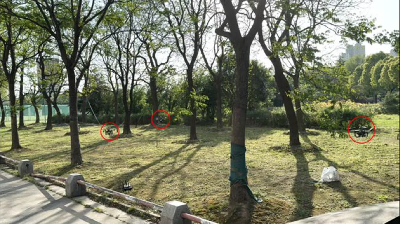
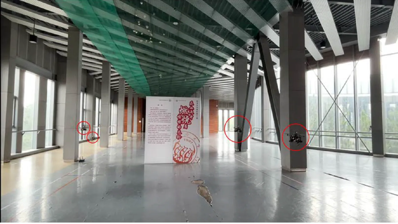
Three lidar-equipped quadcopters from Tongji University in Shanghai explored a patch of park trees with no ground station and no pilot, according to a peer-reviewed paper that a science press-release site surfaced this week. Four of the same drones mapped a 39-by-98-foot (12-by-30-meter) exhibition hall with columns and a display board in their way. Each aircraft carried an Intel NUC computer and a Livox Mid-360 lidar, and every decision about where to fly and how to avoid a teammate was made on board.
The framework is called ESCAPE, and the paper describing it appeared in Autonomous Intelligent Systems, a Springer journal, on December 22, 2025. Its authors are at Tongji, Tianjin University and the Beijing Institute of Technology, and the work was paid for by China’s National Key Research and Development Program, the National Natural Science Foundation of China and two Shanghai municipal science programs.
The paper’s code availability statement says the code “is not available for public release” because of “the confidentiality requirements of the research.”
Three Drones Divided a Park Into Grid Cells and Negotiated Who Flies Where
The swarm splits its search area into uniform grid cells, and the drones trade cells among themselves in pairwise exchanges with no hub giving orders. Each drone then picks a visiting order for its own cells and flies it at 2.2 mph (1.0 m/s) while building a 3D map.
The routing step treats the cell assignment as a capacitated vehicle routing problem and hands it to the Lin-Kernighan-Helsgaun solver, which converts it to a traveling salesman problem with penalty terms. The one change to the routing step of the Racer framework it builds on is a continuity penalty: when a grid cell’s center sits inside a wall or a tree trunk, the drone pays an extra cost equal to the straight-line distance to that center. The point is to stop a drone from hovering in front of a big obstacle and shuttling back and forth, which the authors say Racer does when a single obstacle spans several cells.
Racer came out of the Hong Kong University of Science and Technology in 2023, and its code is on GitHub. ESCAPE reuses Racer’s frontier detection and its B-spline path optimizer.
In the outdoor test, three drones covered a 39-by-66-foot (12-by-20-meter) patch of trees to a height of 6.6 feet (2 meters). Indoors, four drones covered the hall to a height of 5.2 feet (1.6 meters). The lidar’s field of view was deliberately narrowed to 86 degrees horizontally and minus 10 to 60 degrees vertically to mimic a depth camera, and the Livox Mid-360 handled both positioning and mapping. Livox is the lidar maker DJI spun out, and it cut the Mid-360’s point rate in half in September to get the price down for exactly this kind of robot.
The Lower Drone Stops and Hovers While the Higher One Flies Around It
ESCAPE drones avoid each other without exchanging flight paths. Each broadcasts its position, and when two come within range each computes a risk score: how far inside a 4.9-foot (1.5-meter) safety bubble the other drone is, whether they are closing head-on, and how fast. A score above 1.5 triggers avoidance.
Distance counts double in that score, with heading and closing speed weighted once each. Two drones flying directly apart score zero on heading. Two drones on a head-on course score the maximum.
When the threshold trips, altitude decides who moves. The lower drone brakes to a hover and holds position. The higher drone treats the hovering drone’s actual coordinates as a no-fly zone and replans a route around it, with a wider margin vertically than horizontally, which the paper says is to give stronger vertical safety margins. The margin is padded by a 0.01-second allowance for network timing error and 2 inches (5 centimeters) for localization error. The authors argue this is safer than the standard approach, in which each drone optimizes against the flight paths its teammates broadcast, because a late packet means a drone is dodging a path its teammate left a moment ago.
ESCAPE Beat Racer in Seven of Nine Simulated Setups, With Perfect Radio Assumed
Across three simulated office maps with two, four and six drones, ESCAPE finished exploring faster than Racer on average in seven of nine combinations, and faster than ETH Zurich’s Role framework in all nine. Racer was quicker with two drones in the second office and with four in the first.
Each configuration ran 20 times, and the gains were largest on the map with the biggest obstacles. In the third office with two drones, ESCAPE averaged 98.9 seconds against Racer’s 140.4. With four drones there, its average path length was 53.9 meters (177 feet) against Racer’s 96.1 meters (315 feet). On the two simpler maps the differences were under 11 seconds either way.
The collision test defined a failure as any two drones coming within 16 inches (0.4 meters) of each other, and ran four- and eight-drone swarms 50 times each at 2.2 and 3.4 mph (1.0 and 1.5 m/s). The paper reports that success rates rose with the avoidance module switched on, and gives the figures only as a chart.
Both simulation studies assumed perfect localization and perfect communication between drones. The paper’s stated reason for building a new avoidance method is that real swarm radios drop packets and deliver flight paths late. The physical flights did run over an actual network. The team measured about 10.25 megabytes per second of traffic in a six-drone run it does not otherwise describe, and says the flights avoided collisions without noticeable network delays. It gives no collision counts, packet-loss figures or success rates from those flights.
The Money Is Chinese State Science Funding and the Code Is Locked
The paper lists seven funding sources, all Chinese and all public: the National Key Research and Development Program, four National Natural Science Foundation grants, two Shanghai municipal science projects, the Aeronautical Science Foundation of China, central-university research funds and a Tianjin transportation project.
The authors thank the Shanghai Research Institute for Intelligent Autonomous Systems for facilities and computing. One coauthor, Gang Wang, is at the Beijing Institute of Technology’s State Key Laboratory of Autonomous Intelligent Unmanned Systems. The institute is one of the seven universities under China’s Ministry of Industry and Information Technology that are known as the Seven Sons of National Defence. The paper’s contributions section credits Wang with manuscript review and revision, not with the method or the experiments. The paper describes only civilian uses: 3D reconstruction, environmental monitoring and search and rescue in forests. It says nothing about military applications, and the drones in the photos are small research quadcopters.
Withholding code is common in robotics papers, and the Creative Commons license Springer published the article under covers the text, not the software. The dataset is described as public domain. The code is withheld for confidentiality reasons the paper does not name, and whose requirement it is, a funder’s or the university’s, is not stated anywhere in the paper.
The PLA’s 200-drone swarm demo in January and the jamming-resistant hunting swarm claimed in June were military demonstrations with no published method, and this paper publishes its method in full, down to the weights in the risk formula, while keeping the code.
DroneXL’s Take
This is a solid, incremental engineering paper, and the press release built on it is not. “Autonomous drone swarms map complex environments” describes three drones crawling through a patch of park trees at walking pace. I’d call that a real distributed flight and a long way from a forest search, and the authors themselves never call it one.
The physical flights could have settled whether the avoidance logic survives a real radio link, and the paper gives no numbers from them. Stopping the lower drone dead whenever the risk score trips also suits a mapping job more than anything that has to keep moving, which the authors say themselves by listing moving obstacles as future work.
The withheld code bothers me more than the state funding does. Chinese university robotics is state funded by default, and the University of Minnesota’s wildfire swarm work runs on US federal grants the same way. But the paper’s headline result is that it beats Racer, and Racer’s authors put their code online for anyone to run. Until this team does the same, seven out of nine on their own simulator is a result nobody outside Tongji can check.
Source: Autonomous Intelligent Systems (Springer), via Scienmag.
DroneXL uses automated tools to support research and source retrieval. All reporting and editorial perspectives are by Haye Kesteloo. Read our editorial standards.


