Texas DPS Deploys Nation’s First Helicopter-Mounted Drone Detection System
Check out the Best Deals on Amazon for DJI Drones today!
The Texas Department of Public Safety has become the first law enforcement agency in the United States to deploy helicopter-mounted drone detection technology, marking a significant shift in how agencies protect their aircraft from unauthorized drones during high-risk operations. The system went fully operational in August 2025.
The move comes just months after a rescue helicopter was forced to make an emergency landing during the catastrophic Kerrville floods in July, highlighting the growing threat drones pose to emergency operations. For drone pilots, this technology represents a new reality: law enforcement helicopters can now pinpoint not only your drone’s location but also where you’re standing on the ground.
Advanced Detection Capabilities Track Drones and Pilots
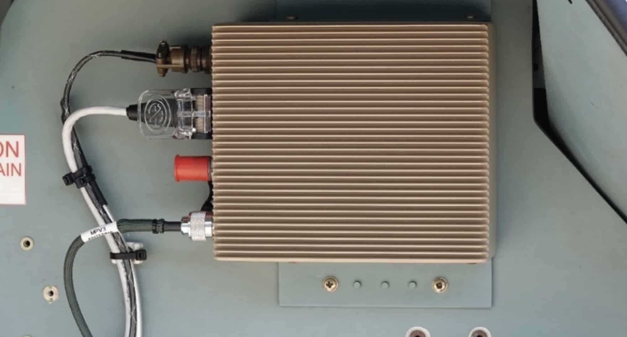
The Airborne Counter Unmanned Aircraft Systems (ACUS), manufactured by Davenport Aviation, uses passive radio frequency detection to identify drones operating near DPS helicopters. The system provides real-time alerts to pilots and dispatch teams, displaying the precise geolocation of both the drone and its operator on the ground.
“As drone use continues to evolve and expand across the country, so does the potential for these devices to be misused in ways that threaten public safety and law enforcement operations,” said Stacy Holland, Chief Pilot of DPS’ Aircraft Operations Division. “Integrating ACUS into our aviation fleet gives us the ability to quickly detect, identify and avoid hostile or unauthorized drones — protecting our aircrews, ground personnel and the communities we serve.”
The system features a “slew-to-cue” capability that automatically directs the helicopter’s camera toward the drone operator’s location on the ground, allowing crew members to relay that information to ground units for follow-up action.
Kerrville Incident Underscores Urgent Need
The deployment follows a July 7 incident during the Kerrville floods when a search and rescue helicopter was struck by a drone and forced to make an emergency landing. The collision grounded critical equipment during operations that ultimately involved rescuing over 850 people from catastrophic flooding that claimed more than 100 lives.
While initially reported as an unauthorized civilian drone, officials later clarified the aircraft was actually an authorized search and rescue drone that malfunctioned and ‘stalled’ at excessive altitude. The incident emphasized both the promise and perils of drones in emergency operations.
How the System Works in Real Operations
Currently installed on one DPS helicopter, the ACUS integrates with the aircraft’s mission computer and displays alerts on the crew’s multifunctional display. DPS Tactical Flight Officers underwent specialized training to operate the technology and interpret real-time data during flight.
The system is designed to enhance situational awareness during border operations, disaster response, and criminal surveillance flights—missions where unauthorized drones could interfere with operations or pose collision risks.
“We’re excited to integrate this cutting-edge airborne drone detection system into our law enforcement helicopter operations,” said Marcus Tomerlin, Assistant Chief at Texas DPS. “It’ll be a game-changer for situational awareness and public safety.”
Detection Only—No Enforcement from Air
DPS emphasized the system is strictly for detection and situational awareness purposes. No direct enforcement or interdiction actions will be taken from the helicopter itself. Federal law currently prohibits civilian law enforcement agencies from deploying counter-drone mitigation technology—only detection is permitted.
Instead, the system provides pilots with crucial information to maintain safe separation from drones while relaying operator locations to ground units. What happens after detection remains at the discretion of local law enforcement and depends on whether the drone operation violates temporary flight restrictions, state laws, or federal airspace regulations.
Multiple other agencies across the U.S. have expressed interest in adopting the technology, according to Davenport Aviation. The FAA has granted field approval for the system, with a supplemental type certificate expected by late October or early November 2025.
DroneXL’s Take
This is a watershed moment for counter-drone technology in civilian law enforcement. Unlike ground-based detection systems that have limited range and line-of-sight issues, helicopter-mounted systems can patrol vast areas and identify threats in real-time during actual operations.
The timing is notable. Texas DPS announced this deployment just three months after the Kerrville incident—a remarkably fast response that suggests the technology may have already been in testing when that collision occurred. The system became operational in August, meaning DPS had it ready to go within weeks of the July floods.
What’s particularly significant is the pilot-tracking capability. Previous detection systems could spot drones, but locating the operator often proved nearly impossible. ACUS changes that equation entirely by using radio frequency telemetry to identify where the pilot is standing, then automatically pointing the helicopter’s camera at that location. For recreational pilots flying in areas where they shouldn’t be, there’s nowhere to hide.
The legal framework here is crucial. Because ACUS only detects—it doesn’t jam, disable, or interfere with drones—it falls within the narrow authority civilian law enforcement has for counter-drone operations. But that detection capability, combined with camera systems that can capture clear images of operators from the air, creates powerful evidence for prosecution.
We expect this to spread rapidly across other states, particularly those with active border operations, large-scale disaster response needs, or frequent wildfire emergencies. The question isn’t whether other agencies will adopt this technology—it’s how quickly.
For drone pilots, the message is clear: if you’re flying near law enforcement helicopters, especially during emergencies or in restricted airspace, assume you’re being tracked. And yes, they can see exactly where you’re standing.
What do you think? Share your thoughts in the comments below.
Discover more from DroneXL.co
Subscribe to get the latest posts sent to your email.
Check out our Classic Line of T-Shirts, Polos, Hoodies and more in our new store today!

MAKE YOUR VOICE HEARD
Proposed legislation threatens your ability to use drones for fun, work, and safety. The Drone Advocacy Alliance is fighting to ensure your voice is heard in these critical policy discussions.Join us and tell your elected officials to protect your right to fly.
Get your Part 107 Certificate
Pass the Part 107 test and take to the skies with the Pilot Institute. We have helped thousands of people become airplane and commercial drone pilots. Our courses are designed by industry experts to help you pass FAA tests and achieve your dreams.

Copyright © DroneXL.co 2025. All rights reserved. The content, images, and intellectual property on this website are protected by copyright law. Reproduction or distribution of any material without prior written permission from DroneXL.co is strictly prohibited. For permissions and inquiries, please contact us first. DroneXL.co is a proud partner of the Drone Advocacy Alliance. Be sure to check out DroneXL's sister site, EVXL.co, for all the latest news on electric vehicles.
FTC: DroneXL.co is an Amazon Associate and uses affiliate links that can generate income from qualifying purchases. We do not sell, share, rent out, or spam your email.


