A lot of new drone pilots think 400 feet is the highest they can ever fly. It isn’t, and in this piece I’m going to show you three different ways you can legally fly above 400 feet, plus the one mistake that can lead to big fines. I’m Greg from Pilot Institute. We’ve helped more than 140,000 people pass their Part 107 exam, and here is everything you need to know about how high you can go.
The Rules Change Depending On Why You’re Flying
There are limits on how high you can fly your drone, but the rules are different depending on how you fly.
If you’re flying strictly for fun or recreationally, the rules under 49 U.S.C. § 44809 apply to you. There is only one way a recreational flight can go above 400 feet, and I’ll get to that later.
For now, let’s talk about flying for non-recreational purposes. If you want to fly your drone for any purpose other than recreation, you have to follow Part 107 of Title 14 of the Code of Federal Regulations. In that case you need to pass a 60-question test to earn a certificate called the remote pilot certificate. And if you’re flying under Part 107, the regulation in § 107.51 says the altitude of the small unmanned aircraft cannot be higher than 400 feet above the ground unless.
400 Feet AGL Is Measured From The Ground Directly Below Your Drone
Before we talk about the “unless,” let’s talk about above ground level, or AGL for short.
You can go up to 400 feet AGL. Simple, right? Sure. Just keep in mind that the height is measured from the ground directly beneath the drone.
Think about it this way. If you’re flying at the bottom of a hill, you can go up to 400 feet. But let’s say that hill is about 100 feet tall. If you fly to the top of that hill, you can actually go up another 100 feet, because the drone is still only 400 feet above the ground when it’s at the top. Your controller will say you’re 500 feet above your original takeoff altitude, but in reality you are only 400 feet above the ground directly below the drone.
It works the other way too. If you take off from the edge of a cliff and fly out over a ravine that’s 600 feet deep, as soon as you go straight out you are in violation of the 400-foot rule. You have to decrease your altitude based on the ground that is directly below the drone. In that case you would have to drop 200 feet to stay within the legal limit.

Way One: The Structure Rule, And Who Can Actually Use It
Now let’s finish that sentence from earlier. Here’s the exception to the rule. The aircraft cannot be higher than 400 feet above ground level unless the small unmanned aircraft (1) is flown within a 400-foot radius of a structure, and (2) does not fly higher than 400 feet above the structure’s immediate uppermost limit.
This is the structure rule, and it’s pretty well known. If you fly next to a 200-foot-tall building, for example, you can fly your drone up to 400 feet above the top of that building, or 600 feet above the ground in that case, as long as your drone stays within 400 feet of the building. That’s kind of a big if.
But here’s the key element a lot of people miss: this only applies to Part 107 operators. Yes, you heard that right. Recreational flyers cannot use this rule to exceed 400 feet above the ground. If you do not hold a Part 107 certificate, you cannot fly above 400 feet in this specific case.
Even with a Part 107 certificate there’s an easy mistake that can get you in a lot of trouble, and I’ll cover that later. For this example, let’s say you have a Part 107 certificate and you’re flying in Class G airspace, uncontrolled airspace.
Flying The Structure Rule In The Real World On Mingus Mountain
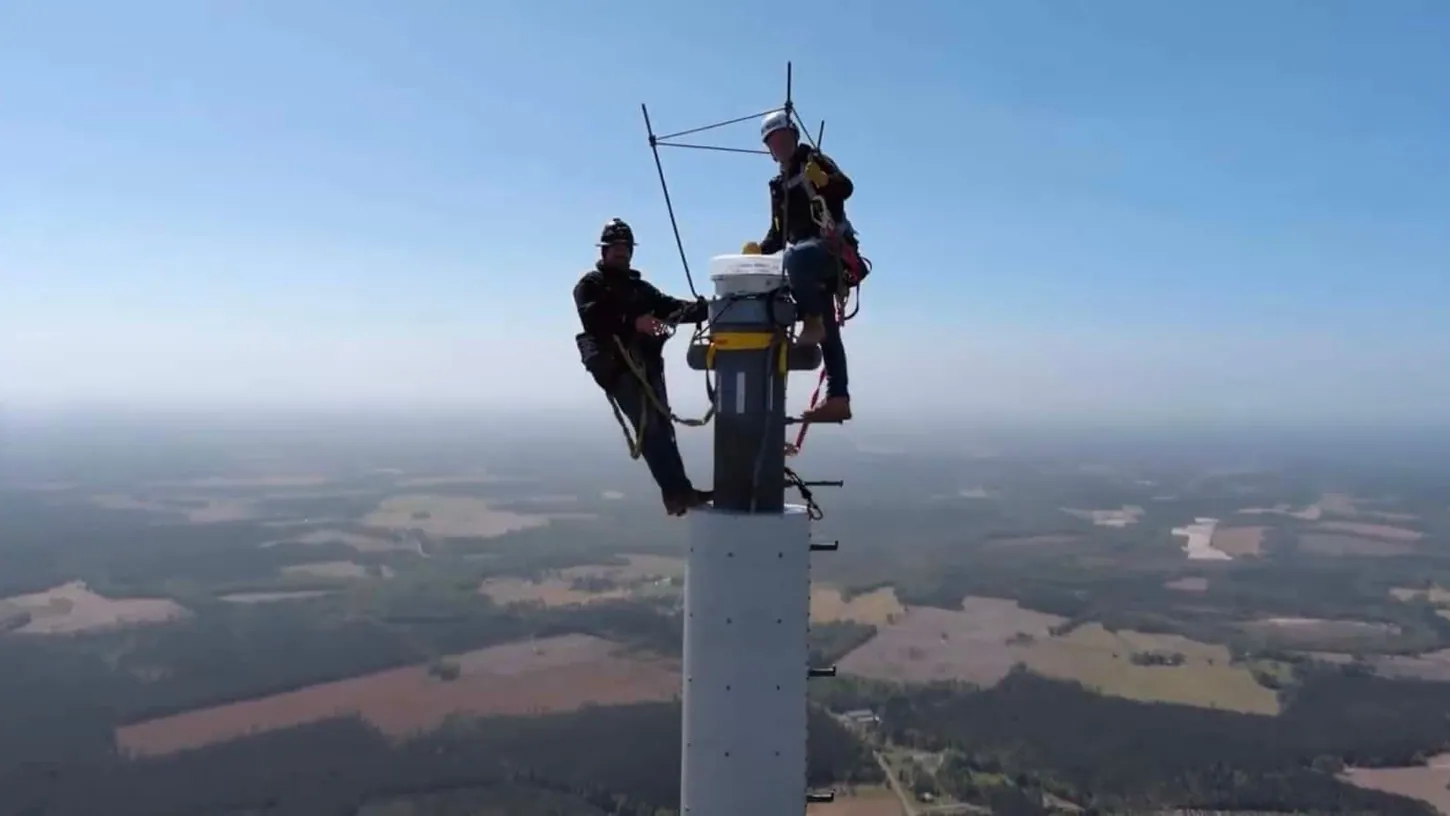
We filmed part of this on top of Mingus Mountain in Arizona. Higher elevation than we’re used to to begin with, but it’s a unique area because directly behind us there’s a cell tower that sits well above our ground level. That tower is what lets us fly above 400 feet AGL here.
The first thing we had to do was figure out how tall the tower actually is. We don’t know exactly, so we take the drone up to the altitude of the top of the tower and use the readout on the controller to determine how high we can fly. Ben guessed 150 feet. Jason guessed 138. Once we got up there, I put the top of the tower at roughly 160 feet, and I was comfortable adding 150 to 400. That makes 550 feet my maximum, which gives us a buffer of about 10 or 15 feet. This isn’t even the tallest tower in the area, so realistically we’ve got another 50 feet with the other towers around us. We built in the margin on purpose and stayed conservative.
The other thing we have to keep in mind is how close we are to the tower. We can go up to 550 feet, but only within 400 feet of that structure. So I kept the drone within a radius of about 500 feet around us. I’m not going to go 500 feet the other way at 550 feet, because then we’re outside the radius. As long as it stays on the tower side rather than over me, that gives us plenty of margin for error.
At 550 feet the controller throws the usual warning that we’re above 393 feet. We know we’re fine. From up there you can see the falling terrain, and the shots look like they came out of an airplane window.
That drop-off raises a good question, because we’re right next to a hang gliding launch point where people throw themselves off the cliff, in a good way. We’re able to fly up to 550 feet AGL from where we took off, but when the drone moves out over that edge, it might technically be up to 1,000 feet above the ground below. That’s still fine, because we’re within 400 feet of the tower, and that’s what covers it.
Push out past that lateral 400-foot line and everything changes. If you’re more than 400 feet from the structure, you have to be back at 400 feet above the ground, even if you’re right next to the cliff the tower is standing on. On the X-axis, if we came out more than 400 feet laterally from the tower, we’d be maybe 1,000 feet above the actual AGL down in the valley. The moment we cross that 400-foot line laterally, we’re in violation, because we’d be above 400 feet and not within 400 feet of the structure. It’s 400 feet of structure, not terrain. Cross that line and you’re back to following terrain AGL without the exception.
Way Two: An FAA Waiver Or Airspace Authorization
So what if you’re not close to a tall structure? You can’t fly above 400 feet, right? Actually, you can. If you have a Part 107 certificate, you can apply for an airspace authorization or an operational waiver.
Getting the waiver takes an application process, and it’s a little complex. The requirements and the application itself can be tricky. To apply, you need to write up a concept of operations and describe your planned mission to the FAA. The biggest thing is that the FAA is looking for how you’re going to mitigate the risk to other air traffic and to non-participants, so consider every part of your operation.
If you want help with a waiver, we have a course called Part 107 Waivers Made Easy that explains all the different types of waivers along with a worksheet to make sure you cover everything the FAA needs to know. For anything far more complex, we can also help through our consulting services. We’ve helped a lot of large corporations get their own waivers.
Inside A 699-Foot Waiver In The Prescott National Forest
We hold waivers at a few locations, so let’s look at one. This site is out in the Prescott National Forest, and it comes with a view and the wind that goes with it. Wind is one of the first things we consider when flying up to 700 feet or so. This is a 700-foot spot. We also have 1,200-foot spots in a couple of different places. On the ground the wind was probably 12 miles an hour, maybe gusting 15, and at 600 or 700 feet I’d guess it was quite a bit more.
We can see the road below and the other section of road coming in above, which means our entire operating area is visible from this one spot. That’s a big part of why we picked it. All of it was pre-planned when we applied for the waiver. We didn’t just pick this place and hope it worked. We’ve flown here before, we know what’s around, we know the access, and we know we can see and verify everything we need to see from this spot.
Ben asked me from behind the camera what the conditions of this waiver actually are. We can fly up to 699 feet here. In the application I described the location, how remote it is, and the airspace, including the fact that we would remain outside controlled airspace. Controlled airspace here begins at 700 feet, so we need to stay out of it. Several things went into the waiver to get approval, but the primary ones are people and property on the ground, airspace, and operations over people and moving vehicles.
This waiver isn’t just above 400 feet. It’s also a beyond visual line of sight and visual observer waiver, covering 14 CFR §§ 107.31, 107.33, and 107.51. We’re allowed to use binoculars, spotting scopes, and other aided vision devices to maintain visual line of sight with the drone and to look for intruding aircraft, so a VO is required for those duties.
For the flight itself, I staged the drone back behind us, came forward to reveal the crew, then panned up to reveal the towers. We went officially over 400 feet, hit max altitude, and at roughly 680 feet we had a great view of the top of Mount Union. That shot is made possible entirely by the waiver. Without it, we don’t get it.
The above-400 portion of this waiver carries a quarter nautical mile radius. I’ve been keeping the drone within about 1,000 feet, a bit more than 1,000 at times, and we ended up around 1,250 feet, so we’re well inside our limits. The biggest thing is that we have to be able to see the drone, which we’re accomplishing with Ben as VO, we have to scan the airspace, which is easy here, and we have to stay within our limits: below 699 feet and within just over 1,000 feet. This is what it looks like at 688 feet if you’ve never been up this high, don’t have a waiver, and don’t have a tower to fly next to.
Way Three: A CBO Fixed Site Authorization
So what if you don’t have a Part 107 certificate? Is there any option to fly above 400 feet? Yes, but there is only one: a CBO fixed site authorization. A CBO is a community-based organization recognized by the FAA. Some CBOs have differing guidelines and limitations on their fixed sites, so check the rules before you go and just send it.
Take Lower Goldwater Lake in Arizona. There’s an Academy of Model Aeronautics FRIA, an FAA-Recognized Identification Area, right there, and it holds an authorization to fly to 700 feet AGL. That means anyone can fly that high in that area. Well, not really. Only people associated with the AMA club for that specific area can fly up to 700 feet. If you see something like this near you, check first to make sure they don’t require you to be a member. Chances are they do.
The Easy Mistake: LAANC Altitudes Are Absolute
Now let’s talk about the easy mistake I mentioned earlier, and it applies to the structure rule.
If you’re flying anywhere in controlled airspace, meaning anywhere outside Class G, you’re going to need a LAANC authorization. That part is usually pretty easy. You apply using an FAA-approved service like Aloft.
Here’s the part that’s easy to miss. Altitudes in your LAANC authorization are absolute above the ground. The approval you get cannot be added to the altitude of any structure, or to the top of trees, for example. The approved altitude must be measured above the ground. For operations that occur in airspace requiring approval, you are limited to the altitude on the UAS Facility Maps unless you have an approved waiver.
There’s a building complex in Tempe, Arizona that is about 240 feet tall. Look at the airspace in that area and you can get a LAANC approval up to 100 feet AGL. That means you cannot fly your drone over that building. You are still capped under 100 feet even though there’s a taller structure nearby.
The only way around this is a special airspace authorization. That’s much easier to get than a waiver, but you do need your Part 107 certificate. And if you don’t have your Part 107, we can help. Just like the 140,000 people we’ve helped before, our Part 107 Made Easy course comes with a money-back guarantee that you’ll pass the test.
You can watch the full video, including the flight footage from Mingus Mountain and our waiver site in the Prescott National Forest, on the Pilot Institute YouTube channel. More of my writing for DroneXL is collected on my author page.