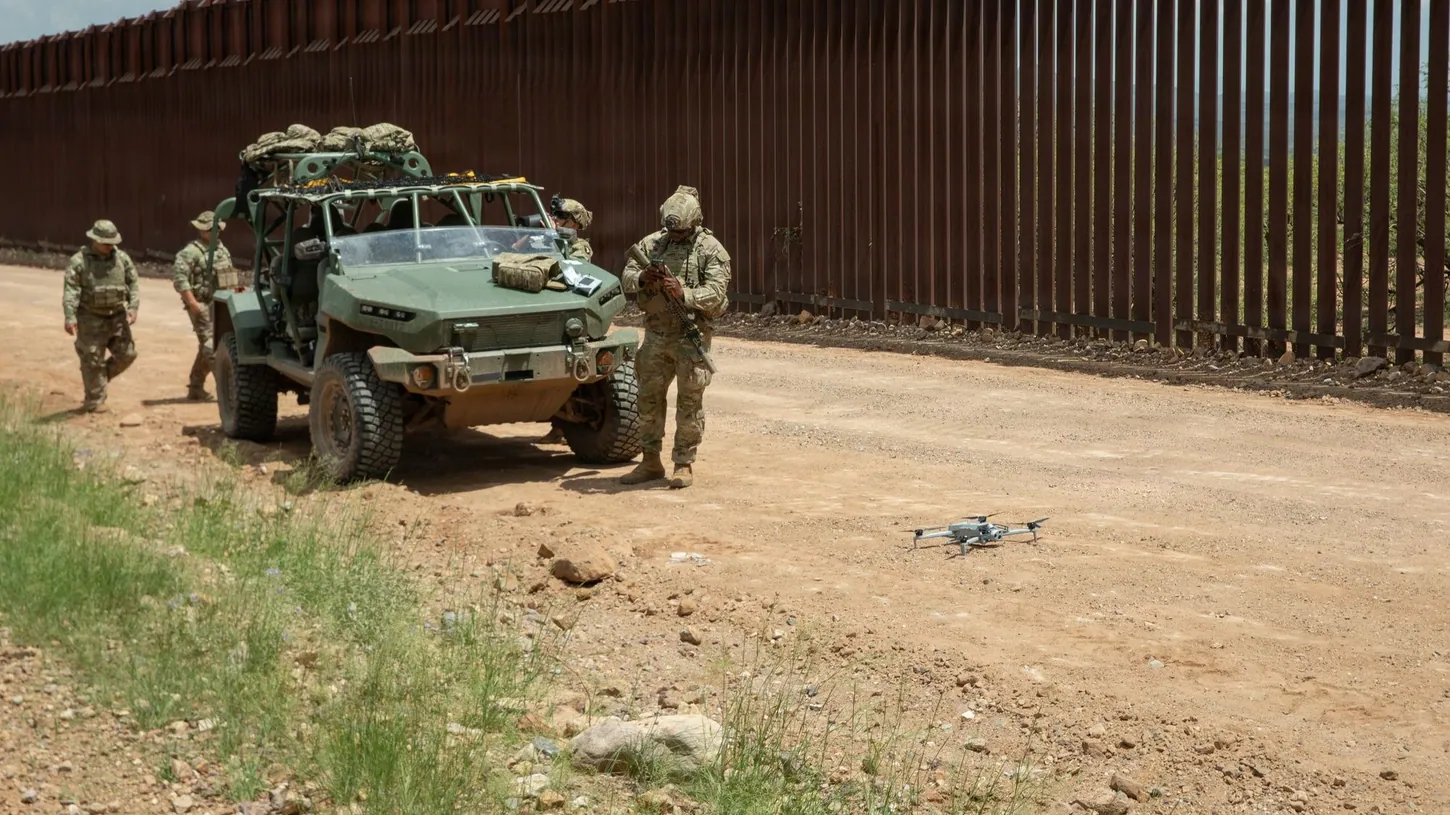
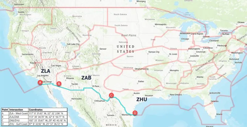
Drones are banned within one nautical mile of the entire U.S.-Mexico border for the next year, from the Pacific coast to the Gulf coast, under three FAA NOTAMs published Friday. The Department of Transportation, the Department of War and the Department of Homeland Security announced the restriction together. It covers the surface to 400 feet (122 meters).
The departments called the temporary flight restriction effective Friday. The NOTAMs themselves, 6/9954, 6/9955 and 6/9956, take effect at 00:00 UTC on October 20, which is Monday evening along the border, and run through October 19, 2027. DroneXL pulled their full text from the FAA’s NOTAM Search on Friday afternoon.
Permission to fly inside the band now runs through U.S. Customs and Border Protection, and the ban covers every drone, including recreational ones under 250 grams.
CBP’s Approval List Leaves Out Routine Commercial And Hobby Flights
The approval list in the NOTAMs has no category for routine commercial work or recreational flying. CBP can clear flights in direct support of national defense, homeland security, law enforcement, firefighting, medevac, search and rescue or disaster response, plus event operations, which the NOTAMs don’t define.
Requests go to [email protected] at least 48 hours before the flight, according to the FAA’s Domestic Notice. Each one needs the operator’s name, FAA certifications and phone number, the flight’s date, time and location, and the drone’s Remote ID, make, model and serial number. First responders working a disaster or other emergency may be eligible for expedited coordination by calling CBP at 951-570-4185.
One nautical mile is about 1.15 miles (1.85 kilometers). That takes in the downtowns of El Paso, Laredo and Brownsville in Texas, along with downtown Nogales, Arizona, and downtown Calexico, California. CBP’s detection figures, which DroneXL reported Thursday, count flights within 500 meters of the line. The no-fly band is more than three times as deep.
The FAA has closed a smaller stretch of border airspace to drones before. In August 2025, at DHS’s request, it banned drones across about 150 square miles north of Nogales through February 9, 2026, citing only “special security reasons,” AZFamily reported.
Violators Risk Criminal Charges And Losing Their Drone
The FAA classifies the band as National Defense Airspace under 49 U.S.C. 40103(b)(3). A pilot who flies in can be intercepted, detained, fined, stripped of an FAA certificate or charged under 49 U.S.C. 46307. The government can also use deadly force against an aircraft judged an imminent threat.
The NOTAMs also warn that the Defense Department (the name the NOTAMs use), DHS or the Justice Department may interfere with, seize, damage or destroy a drone judged a credible threat, under 10 U.S.C. 130i and 6 U.S.C. 124n. In the joint release, Secretary of War Pete Hegseth said the military is equipped with directed energy weapons and that “our warfighters will shoot down any cartel drone that threatens America’s sovereignty.”
Military officials have credited an Army laser with cutting cartel drone flights over the Rio Grande Valley by about 75%. In February, a Pentagon laser destroyed one of CBP’s own drones near Fort Hancock, Texas.
The Border Ban Was Missing From The FAA’s TFR Map And Drone Data On Friday
As of 2:55 p.m. Eastern on Friday, none of the three NOTAMs appeared on the FAA’s graphic TFR list at tfr.faa.gov or in its UAS Data Delivery System, the agency’s public data feed for drone airspace. The FAA’s Domestic Notice does carry a map of the full line.
The restriction starts Monday evening, so the FAA has the weekend to load it. In January, NOTAM FDC 6/4375 banned drones near federal mobile assets, and no flight planning app could show those zones because they moved with the convoys. The border band follows a fixed line that apps can draw.
DroneXL’s Take
The military counted 378 drone incursions on the border between late August and late September. I have no argument with CBP watching the line or with the Army shooting down drones that cross it. I object to the scope. This restriction runs a year and covers downtown El Paso and Laredo. As written, its approval list has no category a roof inspector or a real estate photographer in either city could apply under. A clean no-drone band does make every aircraft inside it easier to treat as hostile, which is the “decision space” Hegseth is talking about. That argument survives a commercial category with CBP vetting each request, and a cartel operator launching from the Mexican side was never going to email CBP for a waiver anyway. The pilots this rule grounds are the ones who follow it. CBP should define event ops and add a category for routine Part 107 work. Anyone flying within a nautical mile of the line should read the three NOTAMs before Monday evening.
Sources: U.S. Department of Transportation, FAA NOTAMs 6/9954, 6/9955 and 6/9956 (FAA NOTAM Search), FAA Domestic Notice, AZFamily
DroneXL uses automated tools to support research and source retrieval. All reporting and editorial perspectives are by Haye Kesteloo. Read our editorial standards.